
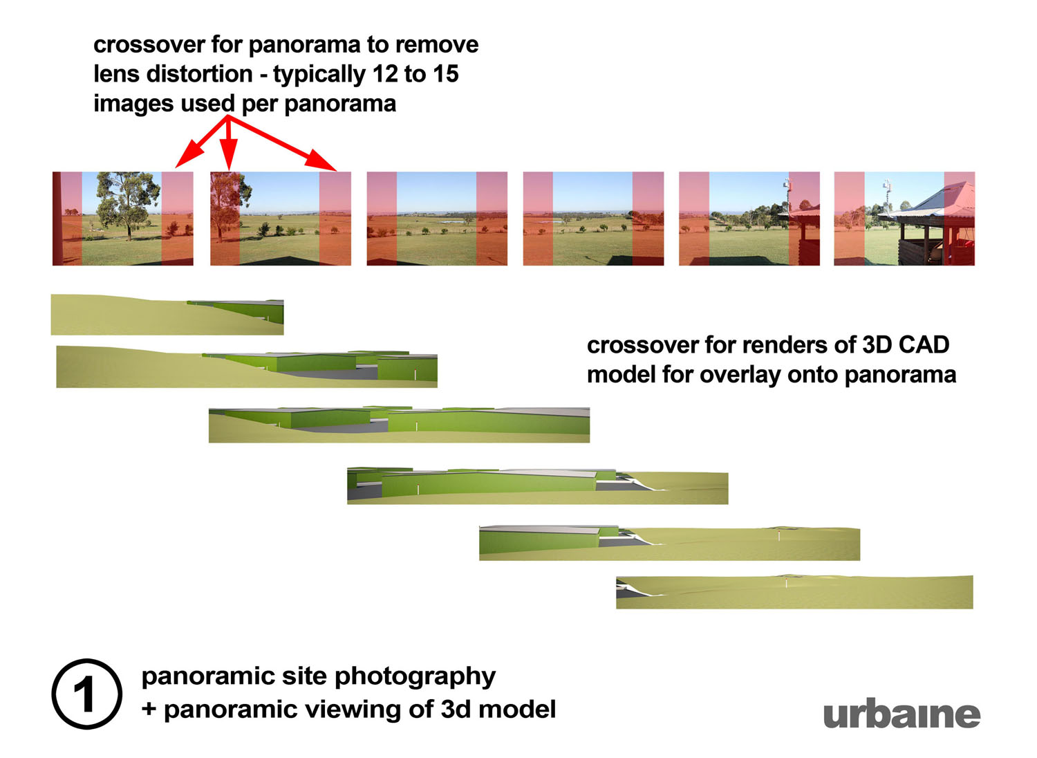
Process and Examples
Each project and site presents a different set of challenges and, over the years, Urbaine VI has developed a variety of methods for verification of the visual impact. Sometimes, one method will be sufficient, but, in most cases, a combination of techniques will be incorporated into the final result. In all cases, a step-by-step description of the visual assessment process accompanies the final images.
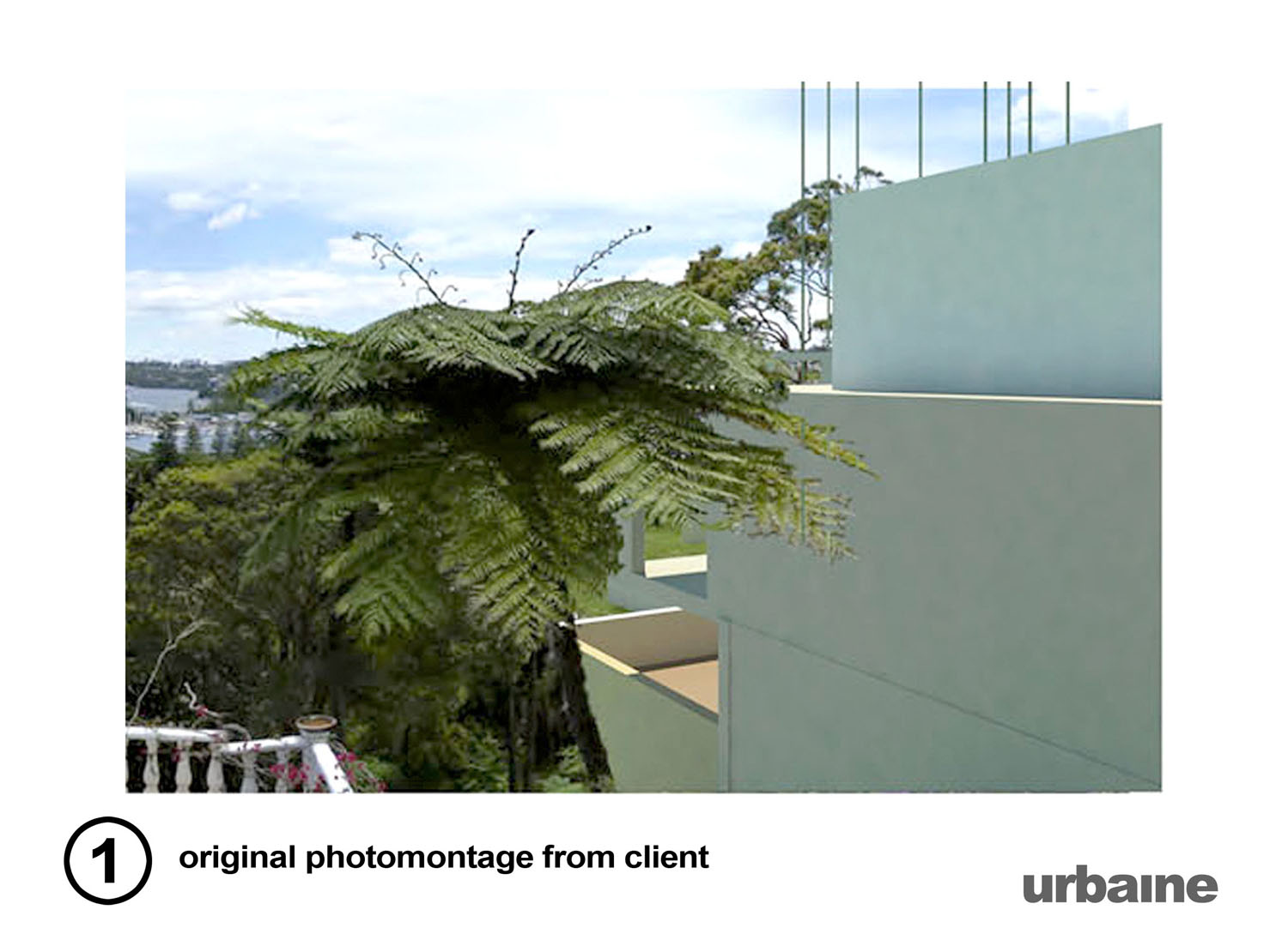
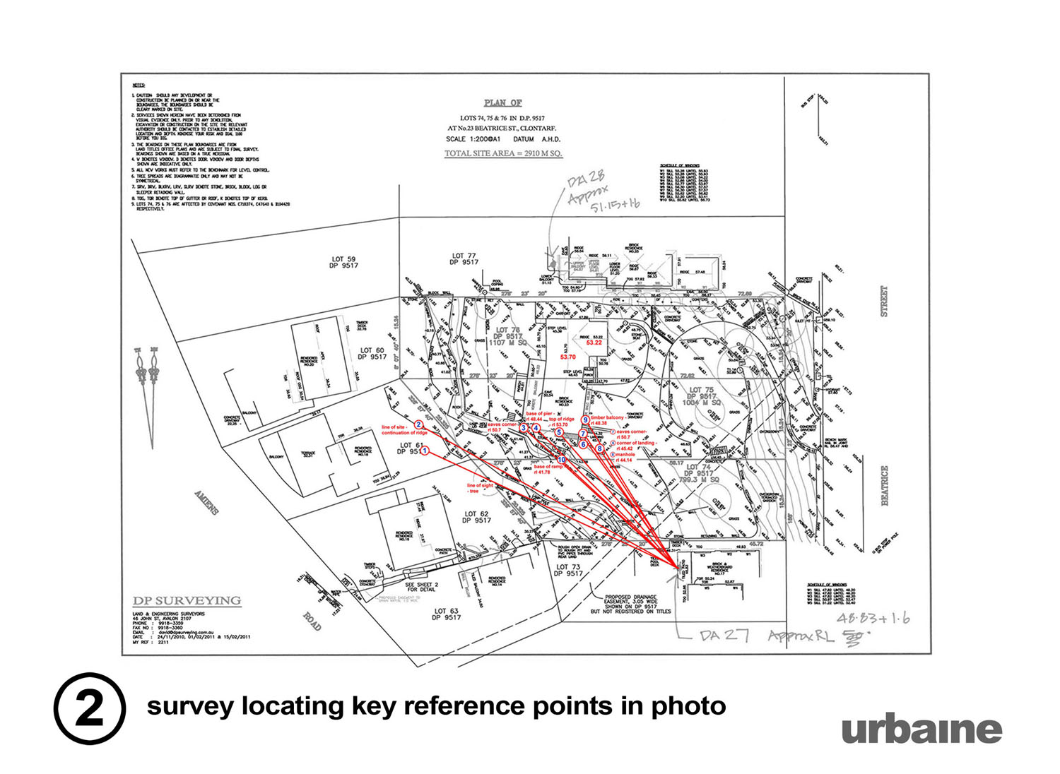
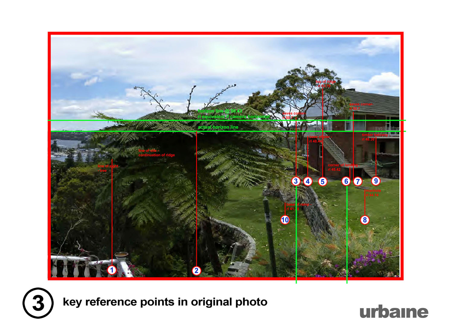
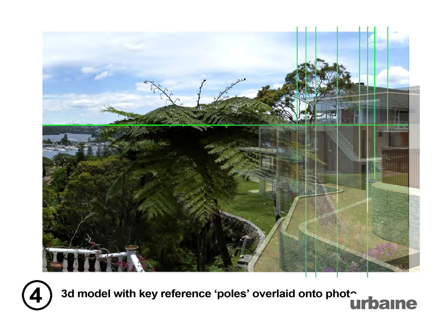
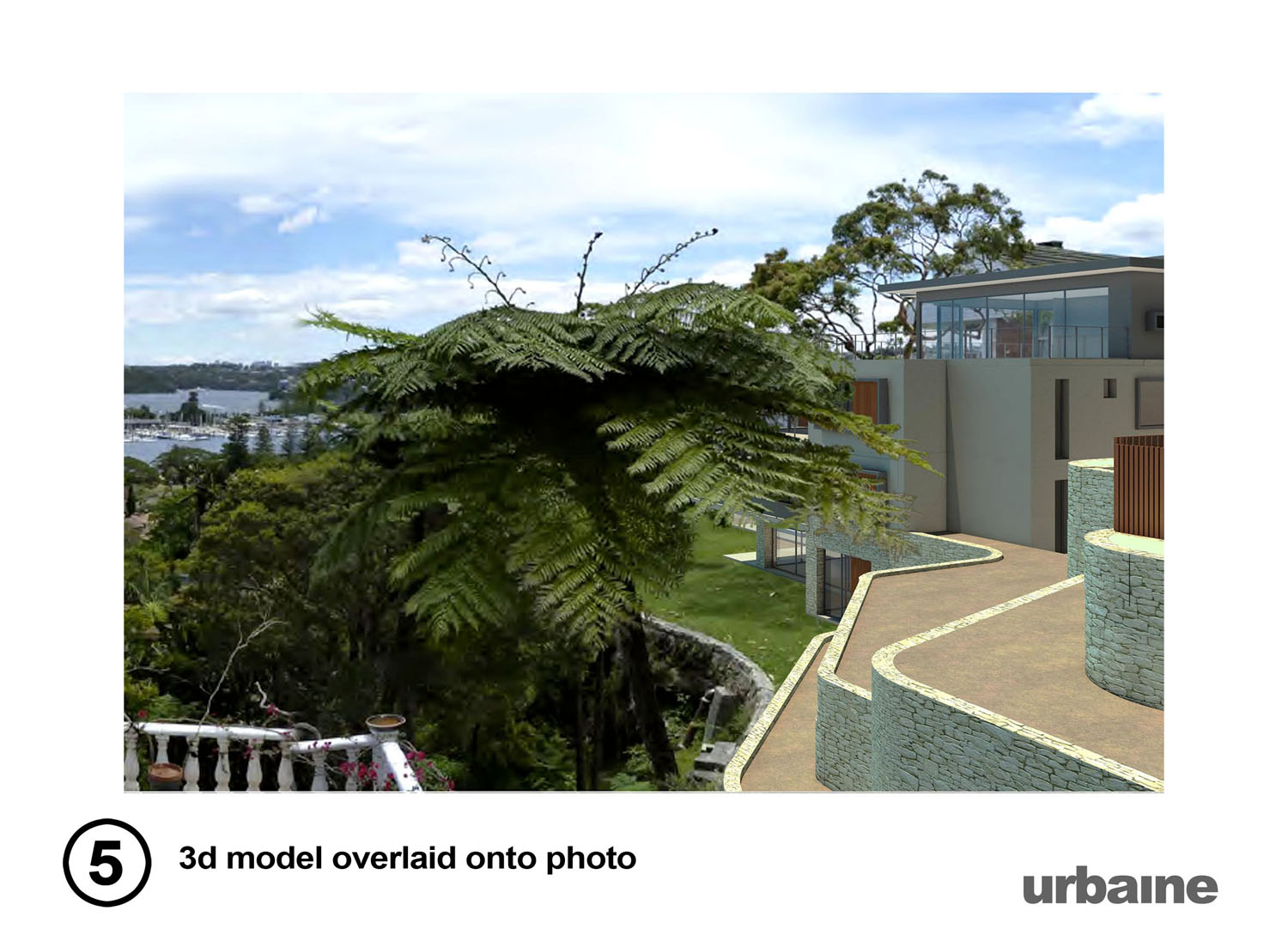
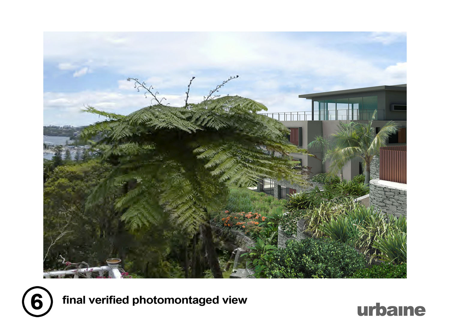
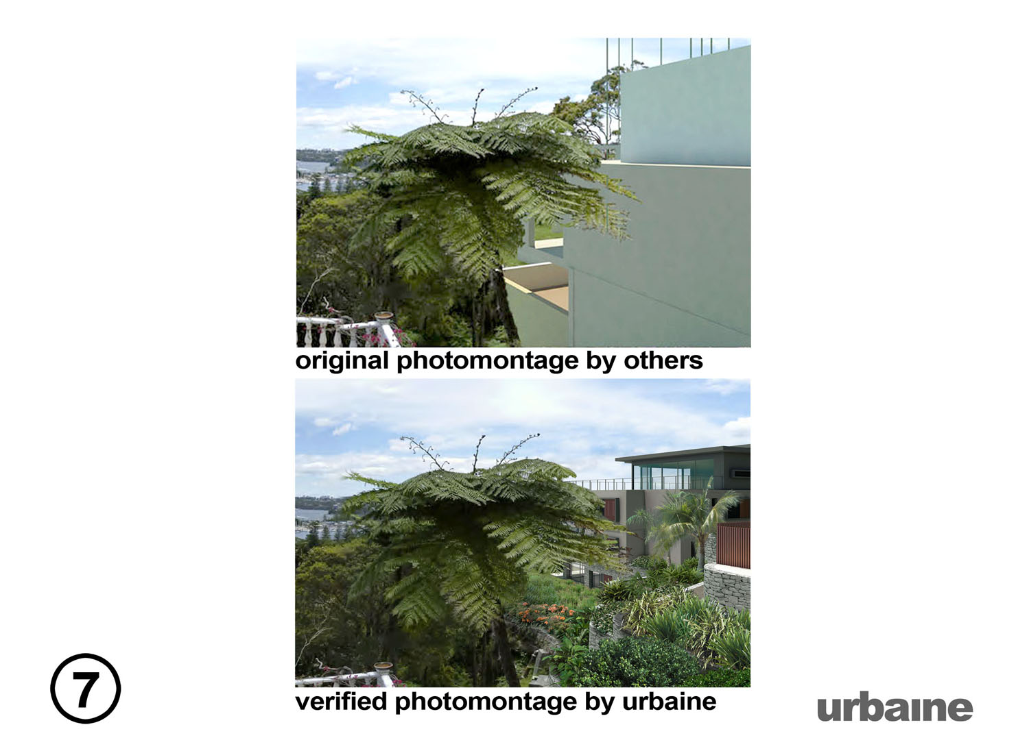
Example 1 - visual impact assessment, Sydney harbour.
Corben Architects, in Sydney had arranged for visual impact studies to be undertaken for a new residential development. Any loss of water views is contentious and the original images failed to demonstrate this accurately. Urbaine VI used a method of incorporating known elements on the site into the 3d model for accurate alignment, both in plan and in vertical alignment. The final image gives a true representation of the actual view loss that would be evident.
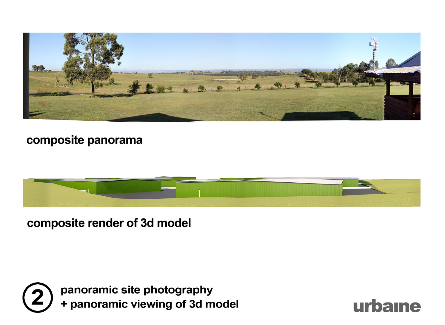
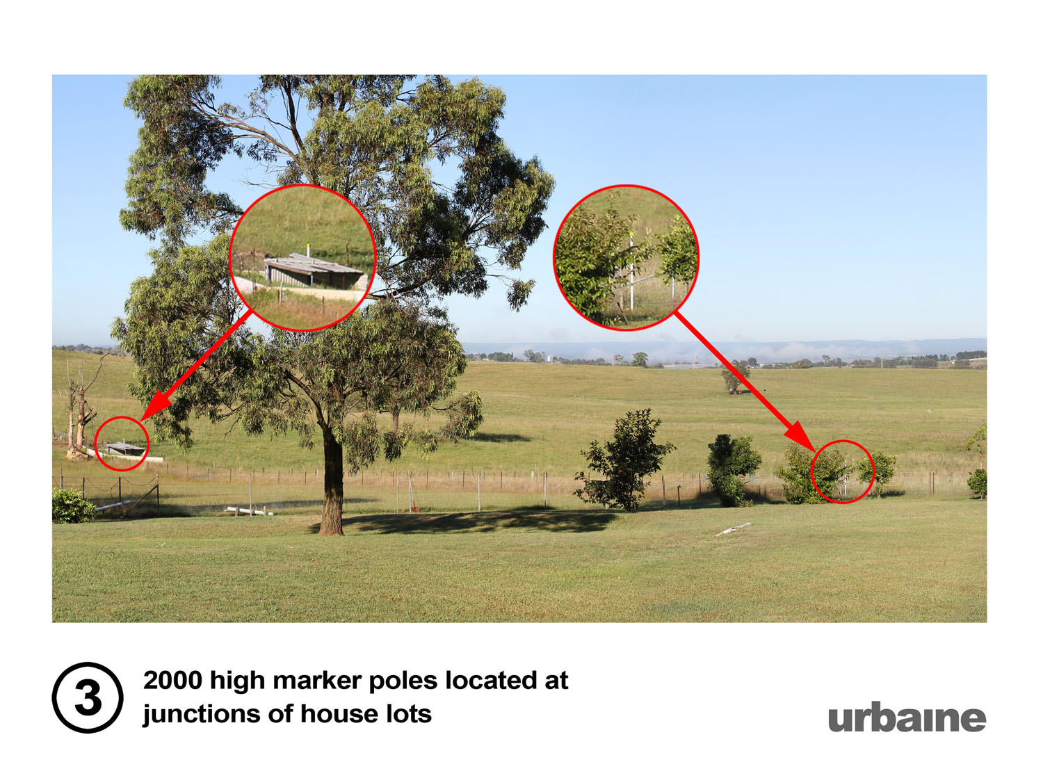
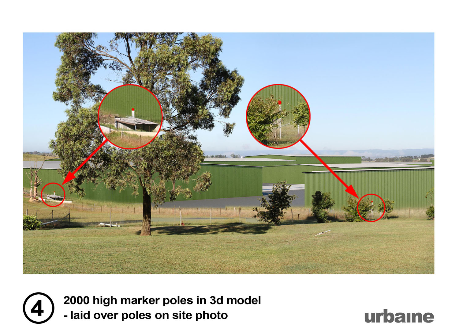
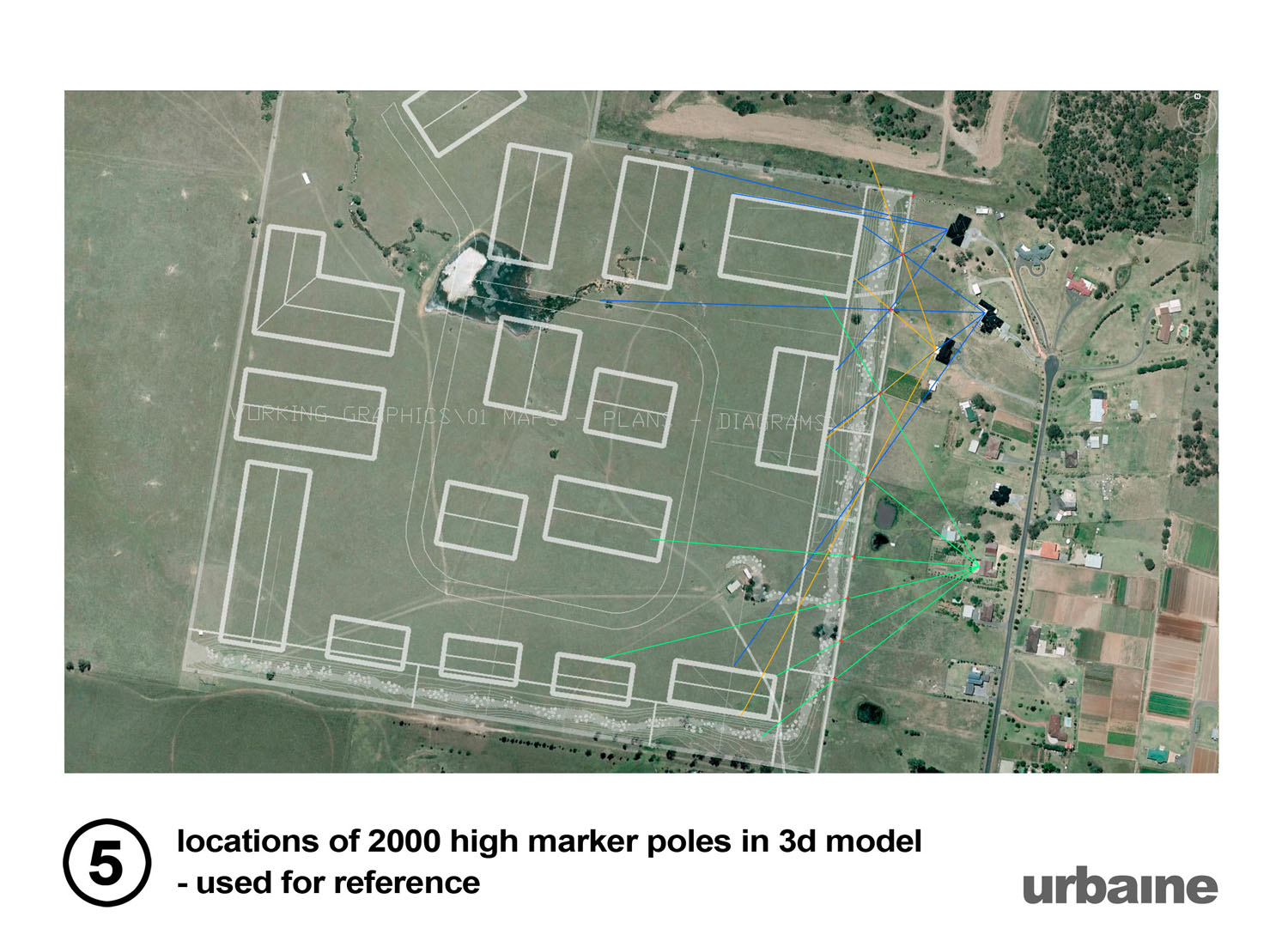
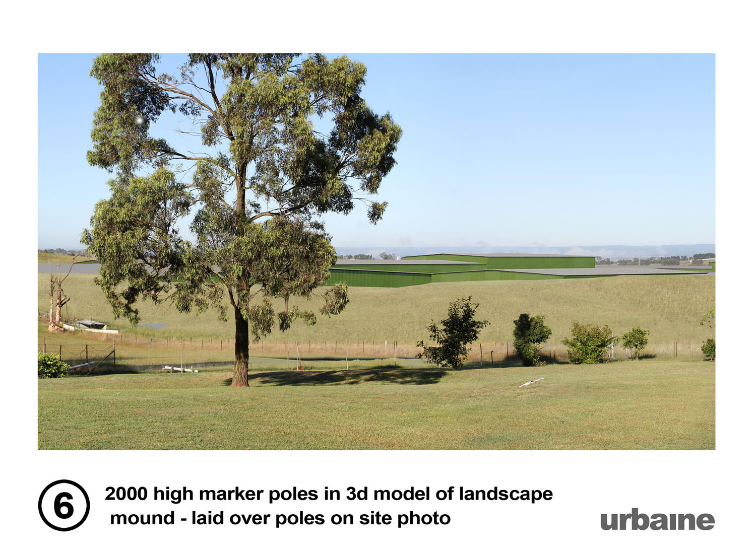
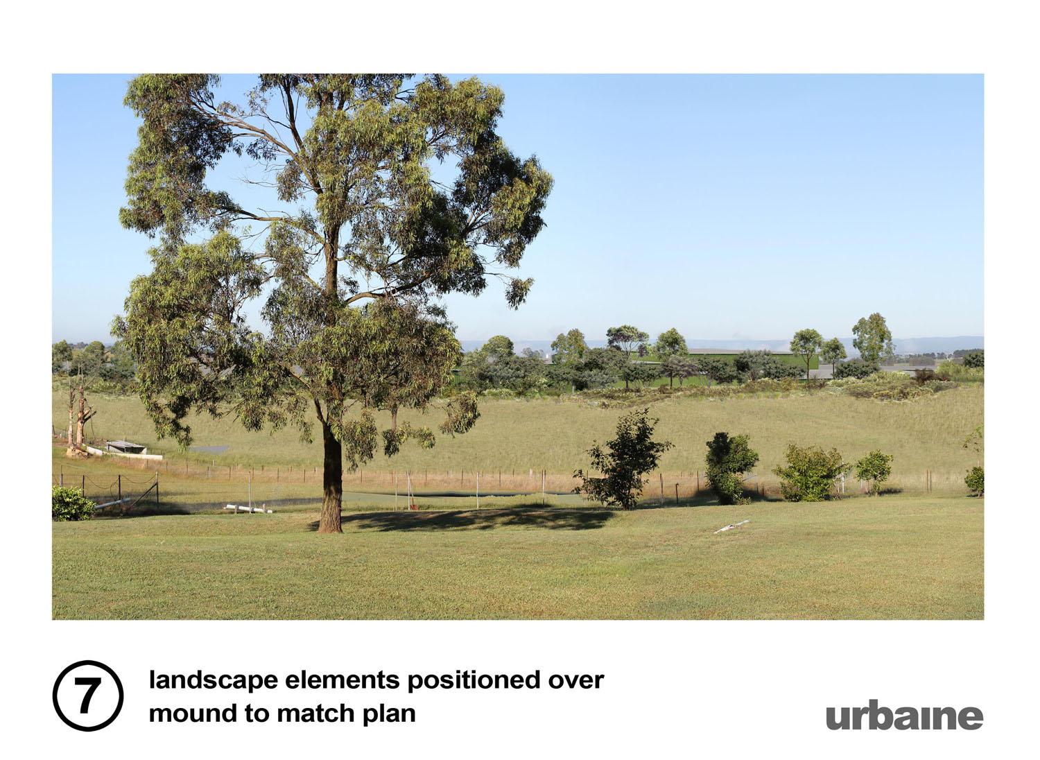
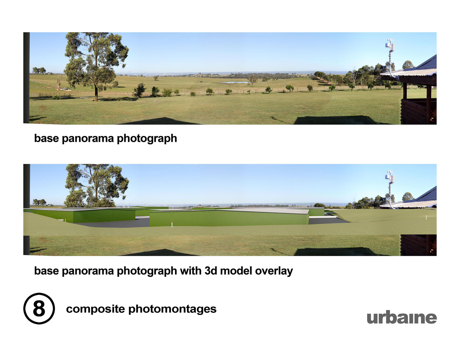
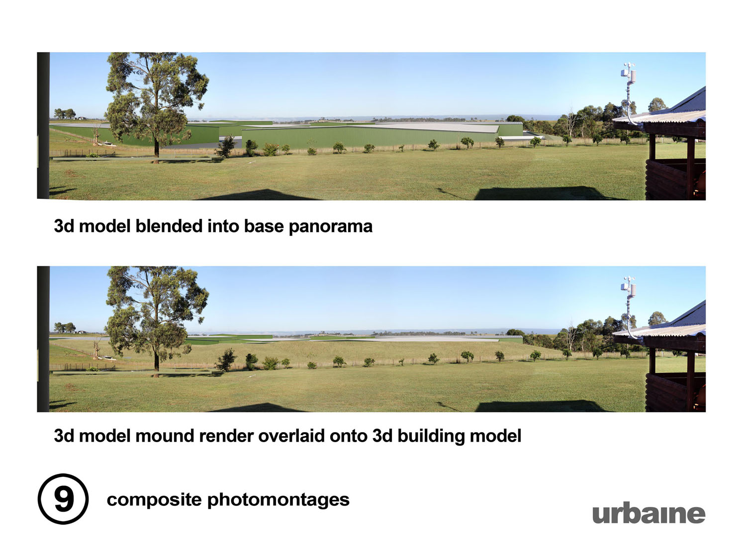
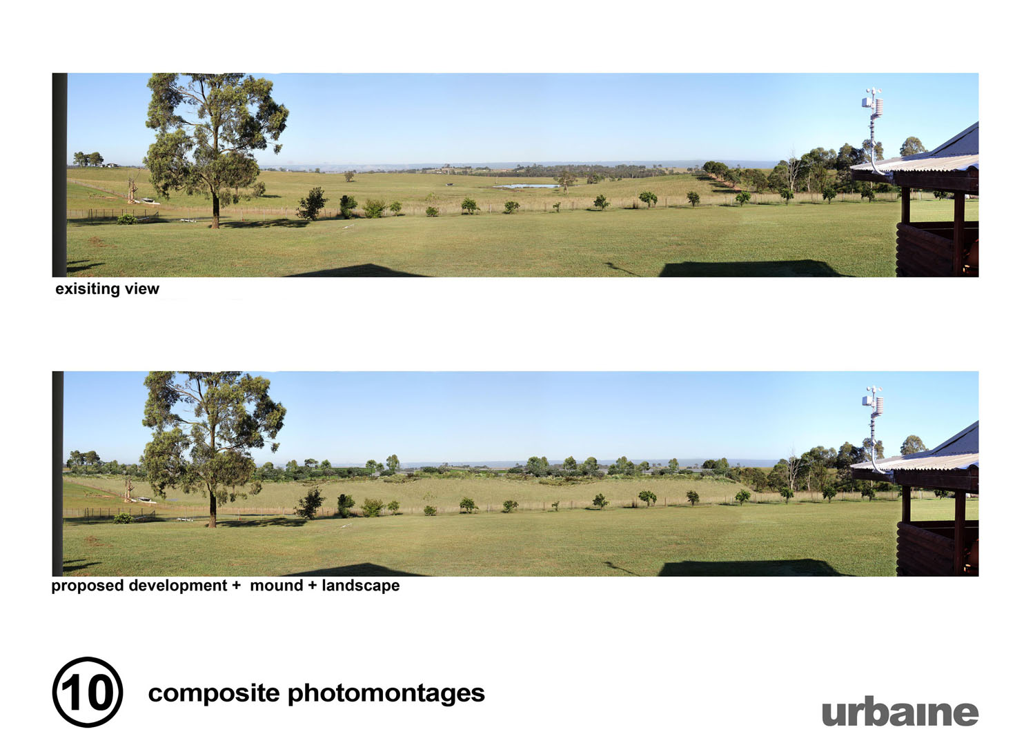
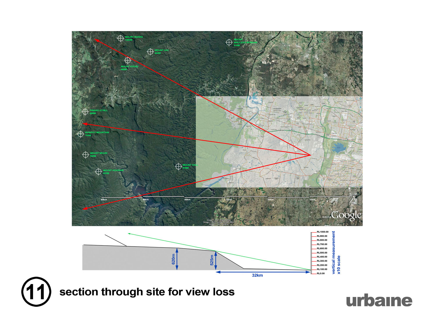
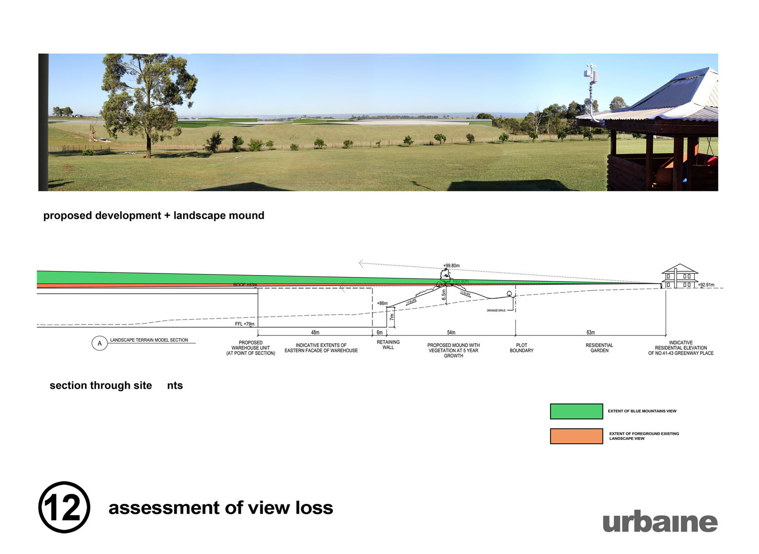
Example 2 - view loss and building obscuration, Western Sydney
A large semi-industrial park in Western Sydney was proposing an increase in the number and size of warehouses on the site. There were may objections from neighbours, citing loss of view of the distant Blue Mountains skyline. Urbaine VI set up physical site poles across the relevant area and replicated these within the 3d CAD model for accurate alignment of the new buildings in plan and height. The outcome was demonstrated in court, with the accompanying images clearly identifying the process.
Example 3 - 4d construction animation
Garden Island, The Australian Navy's maintenance port in Sydney Harbour is undergoing an expansion, specifically in order to take a larger number of vessels. The sequence of construction would have significant impact on its usage and a time-lapse animation demonstrating this was prepared for all stakeholders. This allowed the Navy to understand the areas that could be operational during the construction period.
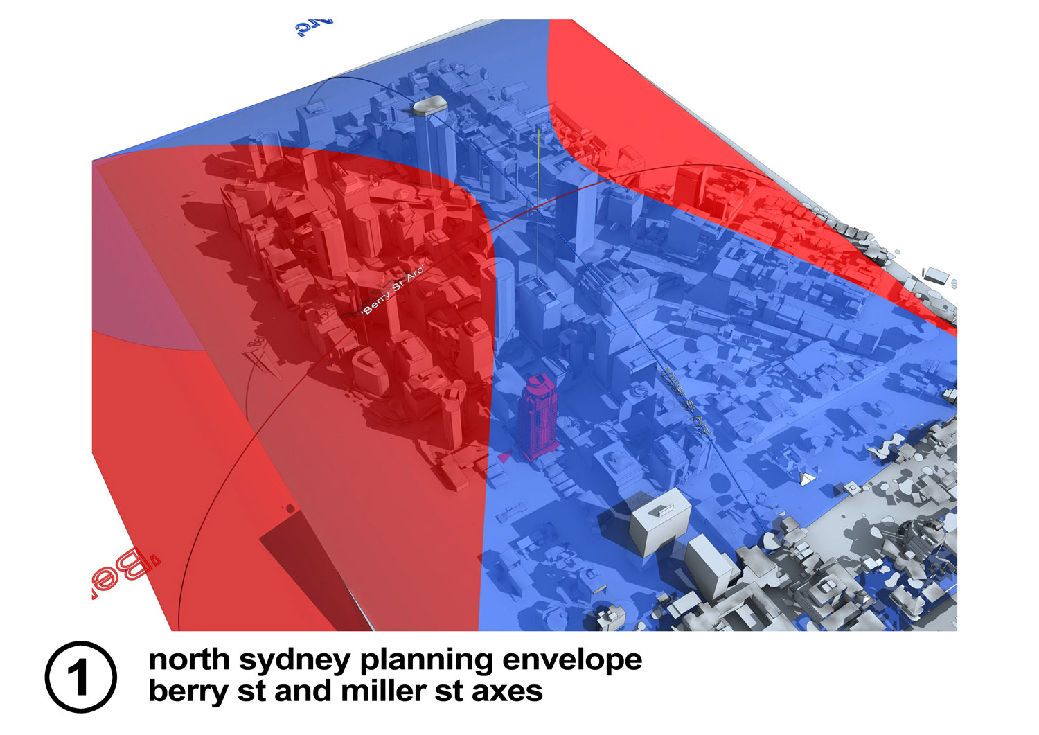
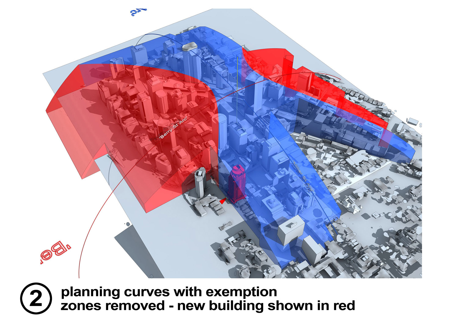
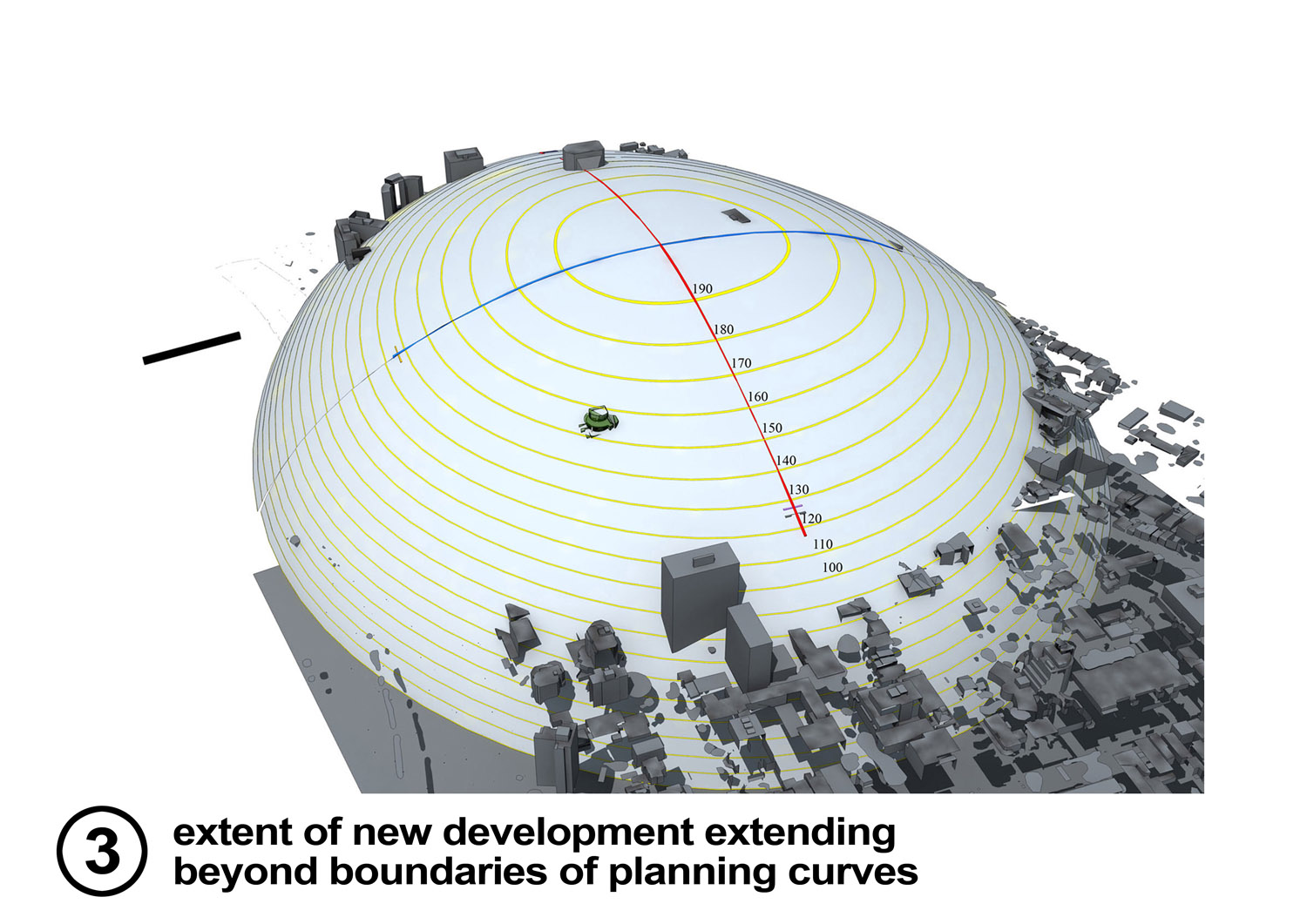
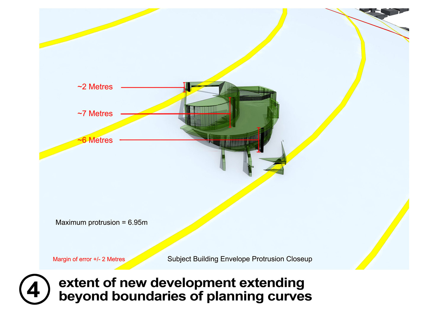
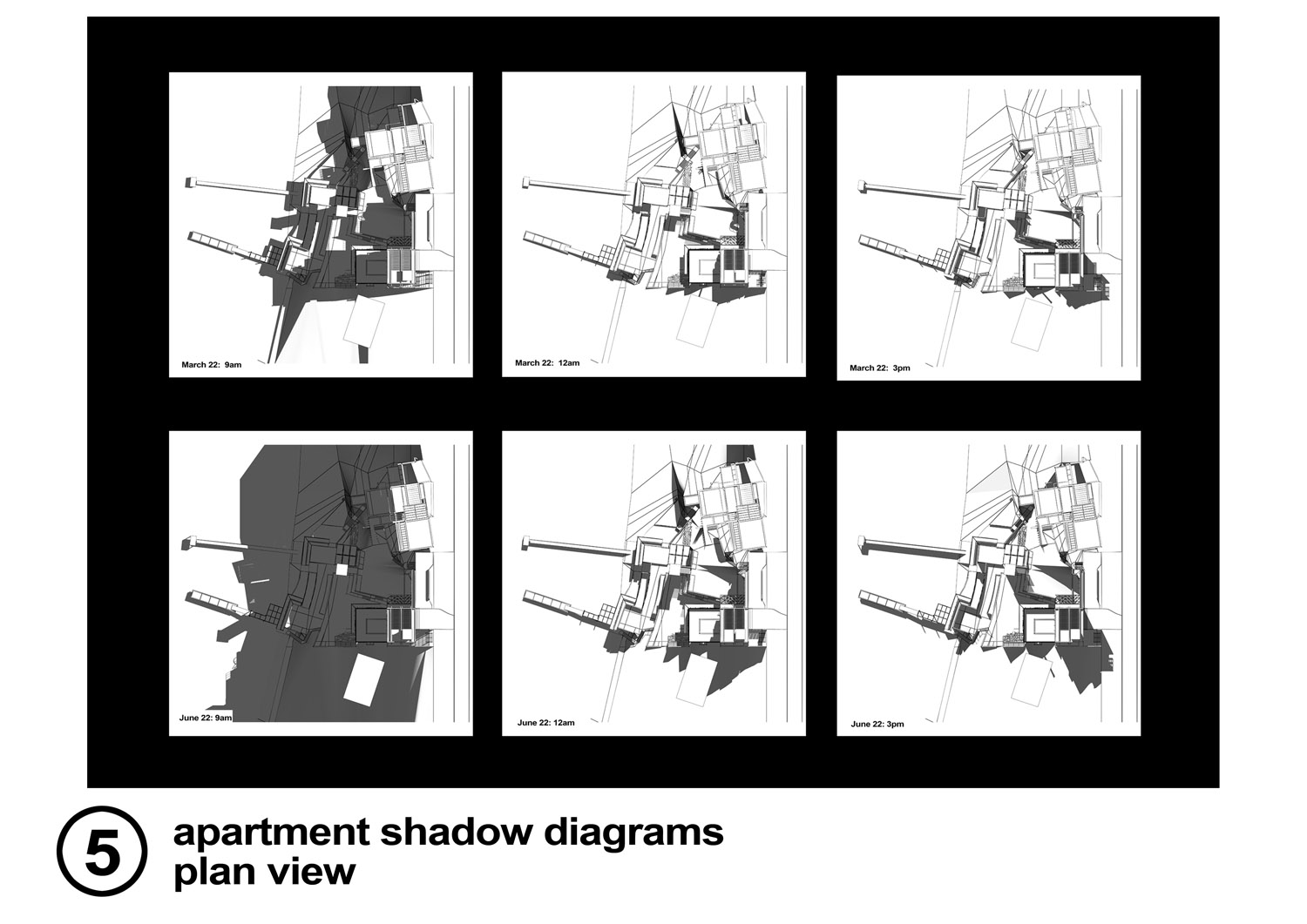
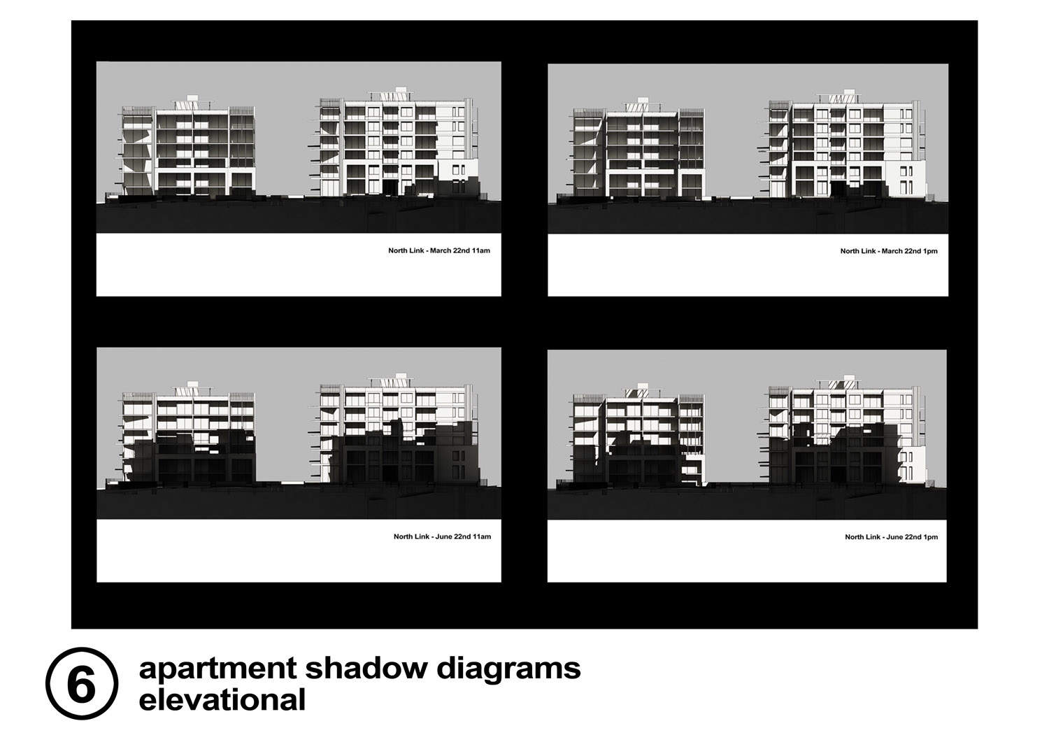
Example 4 - Technical illustrations
A small sample of verifiable illustrations used for planning submissions. They include height studies, relative to town planning envelopes and shadow diagrams, not in plan and elevation.